How to know what particular imagery you get from the VANE Geospatial Platform

Posted on 16 Jan 2017
One of the benefits of the VANE platform is that there is no need to search by scenes and footprints. It is based on a simple assumption: each location in the world has metadata – click on any location and you can get information about all pixels containing this location.
Such projects as cloudless atlases and Google base satellite maps are created according to this basic principle, stitching the best imagery pixels in one seamless mosaic. Based on the scene’s metadata, VANE can choose the best satellite cover – you need to set up a parameter “order=best” for this operation.
As well as this, the VANE language allows you to set up further requirements for your mosaic, providing appropriate parameters in your query:
- no older than (“day>{yyyy-mm-dd}”)
- or put all the latest imagery on the top (“order=last”)
- or within the specific time interval (“between({yyyy-mm-dd}:{yyyy-mm-dd})”).
Then you can go further, applying your custom colours to the result mosaic, according to the VANE language specification.
Just to demonstrate this principle at work, we’ve launched a very basic application called Finder.
How it works
You can follow these steps:
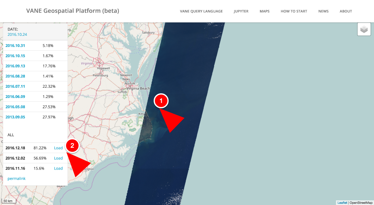
- Click any location on the map to get the list of VANE imagery available for this location. All the imagery that has already been processed is listed on the top.
- Even if none of the actual imagery has been processed yet, you will still be able to access its preview, its metadata and the quick look (here we go to the classic catalogue workflow), and start the processing by clicking the Load button.
It takes from 10 to 50 minutes for the new image to be uploaded and processed.
Don’t hesitate to send us your comments on using the Finder and the VANE platform – we appreciate feedback and look forward to hearing about your particular cases, and your ideas on using satellite imagery and environmental data.